
Onomea Trails
Round Trip Mileage: 1.2 Miles
Elevation Gain: 330’

Alakahi Trail
These two short trails offer a nice hike from the Scenic Drive portion of the Old Mamalahoa road to a small, narrow promontory in beautiful Onomea Bay. The Donkey Trail follows Onomea stream. The trail is nicknamed "The Donkey Trail" because it actually was a trail for donkeys packing cargo from a long-defunct harbor in Onomea bay. The north end of Onomea bay once featured a large natural arch called Onomea arch, but an earthquake shook it down in 1956. These trails are best for sunny days -- it is very slippery when wet, so give them plenty of time to dry out after a rainshower. The Onomea Trail follows the alignment of the Old Government Road into Hawai’i Tropical Botanical Garden, with a short detour along Alakahi Stream. These trails have no fee but you will have to pay if you wish to visit the grounds of the Hawai’i Tropical Botanical Garden.
Trailheads:
Trailhead 1: A few miles north of Hilo on Hwy. 19, find the "Scenic Drive" portion of the Old Mamalahoa Highway. This four-mile long scenic drive connects with modern Hwy. 19 to the south between the 7 and 8 mile markers, and again on the north near the 11 mile marker. Carefully drive the narrow Scenic Drive for either 2.5 miles from the southern end or 1.5 miles from the northern end and look for the Hawai'i Tropical Botanical Gardens. Don't park in the Botanical Gardens lot unless you paid to visit there. Instead, drive just slightly north of the Botanical Gardens parking lot and find a small dirt pulloff on the makai (ocean) side of the road suitable for 2 or 3 cars. Look for a brown sign with yellow lettering indicating the "Onomea Trail" placed by the State Na Ale Hele trail system. Park here, and ensure you are completely off the road.
Trailhead 2: This trailhead is 0.5 mile south of Trailhead 1. It is 2 miles from the northern or southern entrance for the Old Mamalahoa highway. There is off-road parking here for 2 or 3 cars. Look for a brown sign with yellow lettering indicating the "Onomea Trail" placed by the State Na Ale Hele trail system. Park here, and ensure you are completely off the road.
Gear: You won't need much for this short hike down to the ocean. This part of the island gets a lot of rain, so you might want a rain jacket. Don't forget the mosquito repellent.
Map
Hikes: These two hikes are so short that you can easily do them both in less than an hour. It is possible to loop this hike by walking along the Old Mamalahoa Highway, but use extreme caution walking along this narrow road.
The Donkey Trail: From the parking pullout, walk past the Na Ala Hele trailhead sign and follow the steep beginning of the trail as it quickly descends through dense rainforest. Onomea stream is to your right (to the south). When Onomea trail reaches the bay, you'll pass a stream access spur trail that leads you over an embankment into a shallow spot where Onomea stream reaches the ocean. This water contains parasites like Leptospirosis and Giardia, so carefully consider swimming here with open wounds and don't drink the water. There is a small waterfall about 25 feet upstream. The Onomea Trail ends at a scenic promontory in Onomea bay.
The Onomea Trail: From the Old Mamalahoa Highway, follow the Old Government Road as it descends toward the Hawai’i Tropical Botanical Garden. Stay away from the cliffs. Before the trail enters the grounds of the Botanical Garden, take a right turn toward the ocean on the short Alakahi Trail, named because it follows Alakahi Stream toward the ocean. Return to the Onomea Trail and enter the grounds of the Botanical Garden. Unless you paid to enter it, stay on the trail as it heads toward Onomea Bay. Cross Onomea Stream and intersect the Donkey Trail.
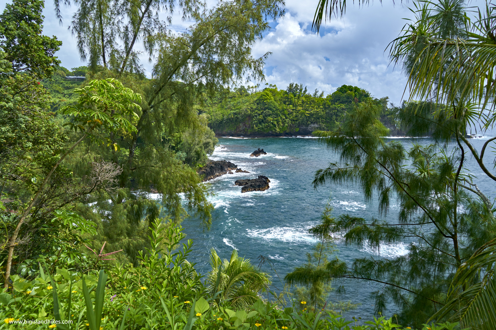
Onomea Bay