
“Ka ʻiliʻili hānau o Kōloa; ka nalu haʻi o Kāwā”
Punalu'u to Kāwā
Round Trip Mileage: 5.5 miles
Elevation Gain: negligible

This difficult hike of moderate length follows old roads and ancient trails through the harsh lava expanses between Punalu'u and Kāwā Bay. Puna luʻu means "fresh spring that is dived for" in the Hawaiian language because the ancient inhabitants of this part of the island would dive with gourds to fill with fresh water in the bay's springs. Punalu'u is one of the most popular black sand beaches on the island of Hawai'i although it's not the best for swimming. It's a real black sand beach as opposed to many others on the island that are more grayish. The beach is popular with sea turtles, so give them a wide buffer. Punalu'u has drinking water, showers, restrooms, camping sites with electricity, and lifeguards during the peak hours of the day. This public park is open 24 hours per day and has free parking.
Kāwā Bay is a picturesque location. The roads into Kāwā Bay require a four-wheel drive vehicle, but this hike allows you to visit it by using the paved parking lot at Punalu'u. It's popular with local surfers and fishermen. This broad bay has several ancient sites of significance as well as extensive burial grounds that are just now being inventoried for historical preservation. People have been visiting Kāwā Bay for decades, but property disputes made access difficult or uncertain at times. Most recently, the state government evicted several residents claiming legal ownership of Kāwā Bay. The Bay has had major changes since then and is now under development as an official park. Kāwā Bay is much cleaner, open to everyone, and an achaeological survey is underway to protect ancient sites and burial sites as Kāwā Bay transitions into an official park. There are currently no facilities of any kind at Kāwā -- plan accordingly to Leave No Trace.
Trailhead: On Hwy. 11 northeast of Naʻālehu and southwest of Pāhala, turn makai (toward the sea) between the 55 and 56 mile markers on Nīnole Loop Road. Follow Nīnole Loop Road to Punalu'u Beach Park.
Gear: Bring plenty of water and sun protection. The terrain is quite rough, so sturdy boots are a good idea.
Harsh Lava hiking
Map
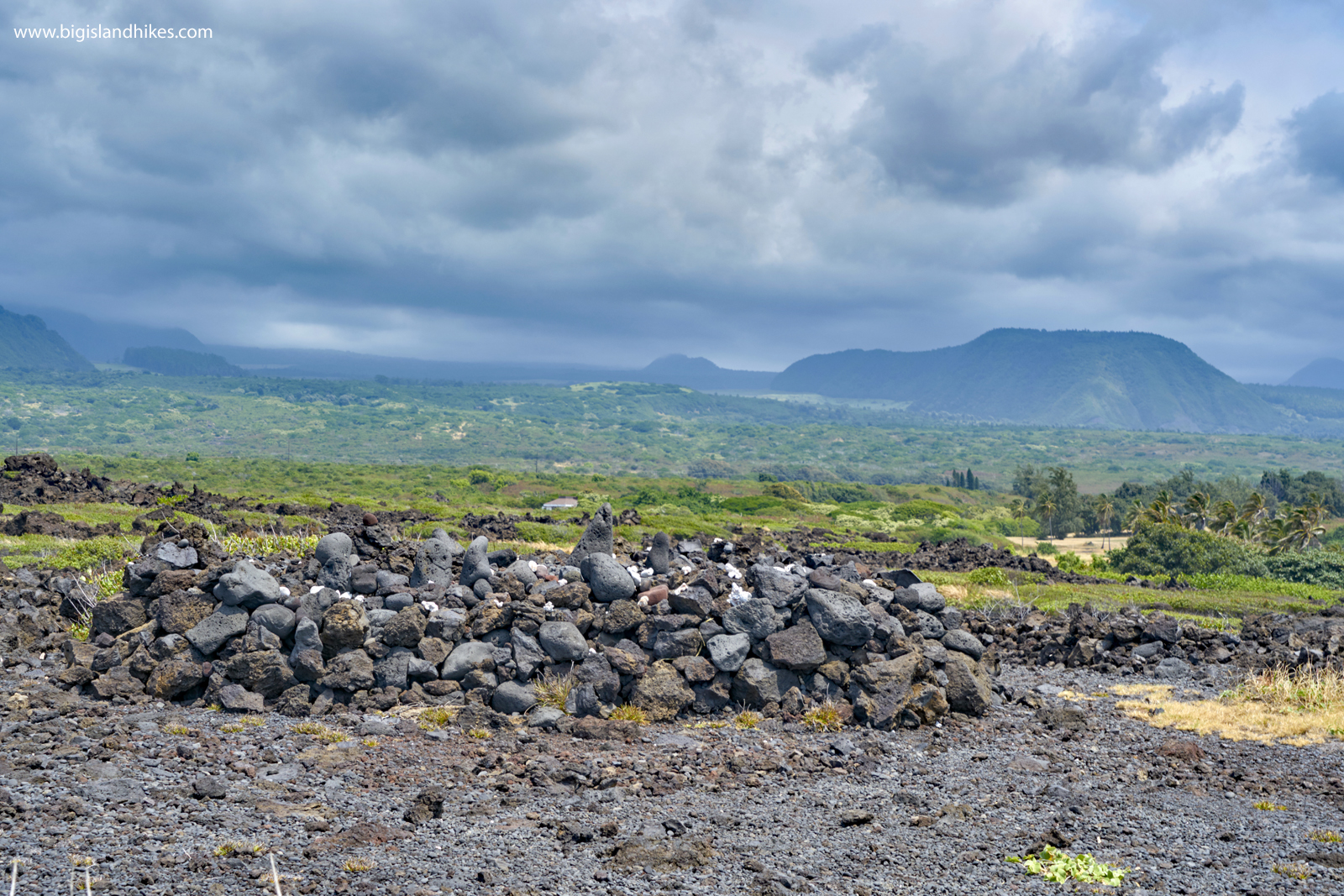
Hike: From the parking area at Punalu'u, walk out to the black sand beach. If there are honu (green sea turtles) on the beach, give this endangered species plenty of room according to state and federal law. When you've enjoyed Punalu'u beach, hike southwest on lava and sandy trails for 3/4 of a mile toward Nīnole Cove. Once a large fishpond, Nīnole is a picturesque cove with medium-size polished lava boulders along the beach. Nīnole means bending in Hawaiian, probably due to the shape of the bay. Adjacent to Nīnole is Kōloa Beach, a small bay with historical significance. The small pebbles in the bay -- called birthing stones (na ʻiliʻili hanau) -- were thought to reproduce and were valued in hula ceremonies and for other purposes (see the ancient quote at the top of the page). From Nīnole, locate an old government road traveling steeply uphill over lava rocks. Above this ramp lies Ka'ie'ie Heaiu, likely dedicated to fishing since it sits above where Nīnole fishpond used to be. The heiau is named for the fibrous 'ie'ie vine, used to make fishing nets. Stay out of the heiau and don't touch the walls or move any rocks. After visiting the heiau, continue along the old government road as it provides easy travel through the lava devastation in the area. This grassy, old road is easy to follow as it travels for 1.25 miles toward Kāwā. There is a small hill along the way. After you pass this hill, vegetation disappears as you begin to cross a newer ʻaʻā lava flow. If you look carefully makai (toward the ocean) shortly after the small hill, you may notice a small ahu (cairn) denoting a rough trail heading toward the sea. Keep this in mind -- this is how you will loop the trail later. For now, continue along the old government road through the rough ʻaʻā lava flow. It ends abruptly when it hits Hīlea Gulch. At this point, hike toward the ocean toward looming Ke'ekū Heiau. This extremely large ancient temple is still in very good condition. Leave No Trace and don't stand on, move, or otherwise disturb any of the rocks in the area. You're now above Kāwā Bay. Carefully pick your way down the slope below Ke'ekū Heiau into Hīlea Gulch. If it is full of water, cross Hīlea Gulch away from the ocean in a safe, shallow spot. You're now at the northern end of Kāwā Bay. You'll find several ancient structures along the coast and behind it. Leave No Trace and don't remove or touch any rocks. On the far end of Kāwā Bay is Kāwā spring, which creates a large brackish pond. It's great for the keikis (children) and for anyone on a high surf day. Swimming is possible in Kāwā Bay, but the surf can be very rough. Use caution. Once you've enjoyed Kāwā Bay, make your way safely back across Hīlea Gulch and climb back up to Ke'ekū Heiau. You can simply retrace your steps back to Punalu'u on the old government road you traveled previously, or you can undertake a bit of an adventure. It's possible to follow the coastline past Ke'ekū Heiau on the ancient Ala Kahakai ("trail near the sea"). This way is difficult to follow and crosses extremely rough ʻaʻā lava flows. Don't even think about it if you're not wearing sturdy, high-top boots. Count on losing the trail from time to time. Pass Ke'ekū Heiau and locate the ancient Ala Kahakai trail. Look for polished, flat stones or flattened areas between lava devastation. Much of the trail is marked by white coral, and this is usually the easiest way to stay on the right track. Take care when the trail travels near to the dangerous sea cliffs here. They are eroding quickly and large waves can easily bash their way over the cliffs. Hike this ancient trail for 3/4 of a mile until you are adjacent to Kuhua Bay. The trail takes a hard turn north near the bay and heads mauka (inland) back to the old government road you hiked earlier. Once you intersect the old road, retrace your steps back to Punalu'u.
Heiau